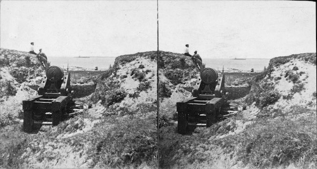
| Credit: | by Barnard (George N.) |
|---|---|
| Date: | 1865.03-04 |
| Negative Size: | 4 in. x 7.5 in. stereo |
| Equipment: | Barbette carriage (center pintle-wood); Brooke Rifle gun; cannon |
| Locations & Lines: | Charleston Harbor; Charleston SC; Fort Moultrie SC; Fort Sumter SC; South Carolina; Sullivan’s Island (Charleston SC) |
| Military Units: | CS Army; US Army |
| Sources: | Library of Congress; SMU Libraries; USAMHI – MOLLUS collection |
$5.99
File Details: AMUKm, 800 DPI, TIFF, Original Photograph, 12.5 Mb
Image ID: AMUK
Printed label affixed to original prints: No. 25. A View of Fort Sumter From Fort Moultrie. Charleston, S. C. This picture presents a view of Fort Sumter, as taken from Fort Moultrie. Fort Sumter is situated about 1,700 yard from Fort Moultrie, in a Southwesterly direction. It is surrounded by water, as shown in the picture. It was built about thirty years ago, under the superintendance [sic] of Capt. Bowman, of the Engineer Corps. It was considered one of the best built Fortresses in the country. It is located on the South side of the main entrance to the harbor, and occupies an area of about five acres. The foundation was built of stone, ship load upon ship load, having been sunk upon a reef or shoal running out from Fort Johnson, upon which the Fort was built. It was a strong casemated [sic] brick work of five faces, or angles, designed to mount two tiers of guns in embrasure, and one en barbette. It is about midway between Fort Moultrie, on Sullivan’s Island, and Morris’ Island, and about three and a quarter miles from the City of Charleston. The view also shows one of the merlins of Fort Moultrie, as they were constructed by the Confederates, with sand.

